Specifying a Model
Below it is described how individual elements of a model can be entered into the project.
WHen defining the model of the waterway in question, the user specifies:
- a number of route legs
- Traffic Lateral Distribution on each leg and in each sailing direction
- Traffic Volume Distribution (i.e. number of ships and types of ships) for each leg in each direction
- Causation Probability factors for each leg in each direction and for each type of incident
- a number of polygons defining grounds and hazards, defining their depth
For junction waypoints (i.e. waypoints to which more than two legs are adjacent) the proportion of ships sailing from one leg to the other must also be specified.
Routes, Waypoints and Legs
A new Leg is entered by selecting the Leg tool ![]() from the menu bar and clicking the left mouse button at the location where you want the leg to start.
from the menu bar and clicking the left mouse button at the location where you want the leg to start.
Then move the cursor to the location where you want the Leg to end, and click the left mouse button again. The Leg end points are waypoints and are drawn as blue dots.
If you want to draw a new Leg that is connected to a specific Waypoint, just move the cursor over the waypoint and observe that it changes shape from an arrow to a finger ![]() .
.
Click the left mouse button to start the new Leg, move the cursor where you want this leg to end and press the button again.
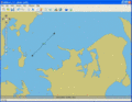
Entering a new Leg

Connected Legs


If you want to move a Waypoint/Leg, select the Pointer tool![]() from the menu bar and drag the Waypoint dots.
from the menu bar and drag the Waypoint dots.
Alternatively you may double-click (left mouse button) and edit the latitude and longitude coordinates of the node directly.
The displaying of Leg numbers and distributions graphics can be turned on/off by pressing the ![]() button located below the zoom slider.
button located below the zoom slider.
Deleting an object
To delete an object chose the Recycle Bin Tool ![]() .
.
Once the Recycle Bin Tool has been selected, click on the objects you wish to delete.
Defining Traffic Lateral Distribution
For each leg a Traffic Lateral Distribution must be entered.
Specification of the traffic distribution requires specification of the traffic spread across the waterway and specification of the traffic composition and the intensity.
Note that a ferry travelling between two ports can theoretically collide with itself in IWRAP. To remedy this change the causation factors.
Select the Pointer Tool ![]() from the menu bar and double-click on the relevant leg. This opens the Leg Editor.
from the menu bar and double-click on the relevant leg. This opens the Leg Editor.
When selecting the Distribution tab, the window shown in figure B below, appears. Here the distribution in each direction can be given.
The traffic distribution will always be shown as "North" and then "South", as apparent in figure B below or, alternatively “West” and “East”, depending on the orientation of the route.
The traffic distribution may be composed by a weighted sum of a series of standardised probability distributions.
Distributions are added by pressing the “Add” button and selecting a distribution from the look-up list that appears.
The method for specifying the parameters of the distribution may be selected from the scroll-bar “Input method”.
Definition of the traffic distribution at least requires specification of the mean value and the standard deviation of the probability distribution and specification of the (relative) weight of this distribution in the combination.
In the example the north bound traffic is a combined normal and uniform distribution, where the normal distribution is weighted 64% and the uniform distribution is weighted 36%.

Figure A

Figure B - Leg Editor

